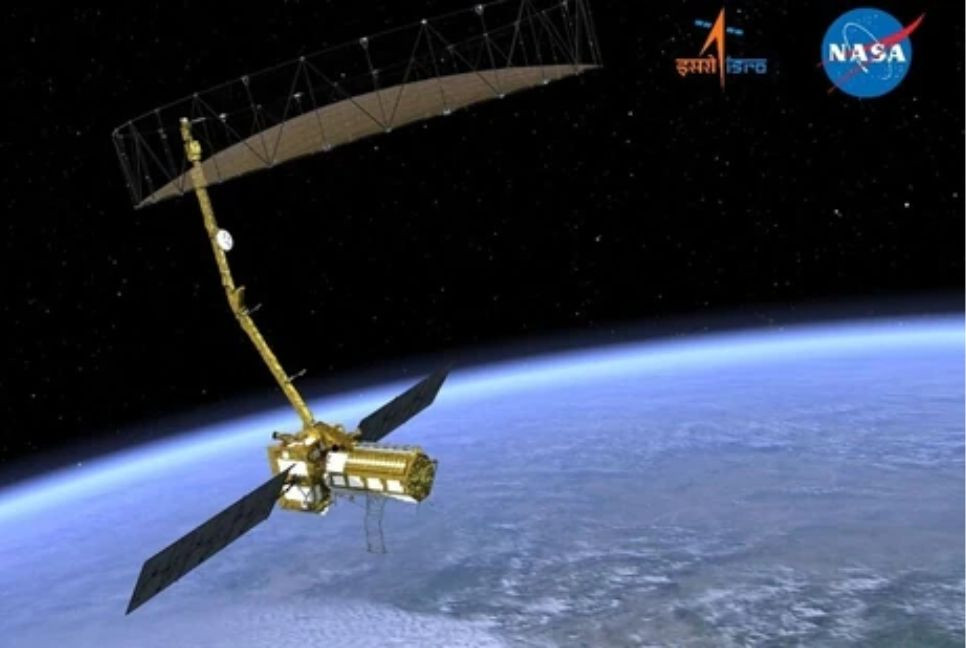
The Indian Space Research Organisation (ISRO) and the National Aeronautics and Space Administration (NASA) will launch a satellite, NISAR, from Satish Dhawan Space Centre in Sriharikota on July 30 at 5.40pm (local time).
India's GSLV-F16 rocket will inject the Synthetic Aperture Radar (NISAR) satellite into a 743-km Sun-synchronous orbit with an inclination of 98.4 degrees.
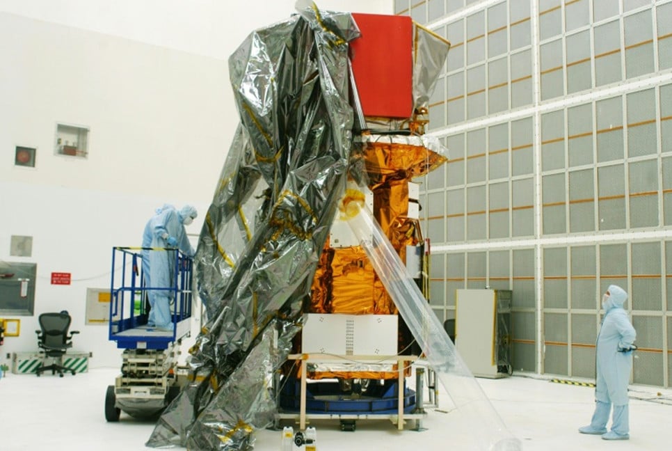
The launch of satellite NISAR, the first joint Earth observation satellite by ISRO and NASA, will mark a key milestone in Earth observation technology.
What is NISAR?
NISAR is a Low Earth Orbit (LEO) observatory being jointly developed by NASA and ISRO.
- According to the Indian space agency, NISAR will map the entire globe in 12 days and provide spatially and temporally consistent data to understand changes in Earth’s ecosystems, ice mass, vegetation biomass, sea level rise, groundwater, and natural hazards, including earthquakes, tsunamis, volcanoes, and landslides.
- According to an official statement from ISRO, it is an L—and S-band, global, microwave imaging mission with the capability to acquire fully polarimetric and interferometric data.
- The data acquired through S-band and L-band SAR from a single platform will help scientists understand the changes happening to Planet Earth.
- The joint mission will accomplish multiple tasks, including measuring woody biomass and its changes, tracking changes in the extent of active crops, understanding the changes in wetlands' extent, and mapping Greenland and Antarctica's ice sheets and the dynamics of sea ice and mountain glaciers.
- According to ISRO, the first 90 days after launch will be dedicated to commissioning, or In-Orbit Checkout (IOC), which aims to prepare the observatory for science operations.
Source: Hindustan Times
Bd-pratidin English/FNC