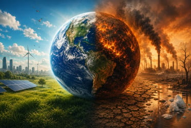
The world’s rainforests, often called the "lungs of the earth," play a vital role in fighting climate change by storing vast amounts of carbon.
Yet, with over one and a half trillion trees spread across tropical rainforests, accurately measuring the amount of carbon stored has remained a daunting challenge—until now.
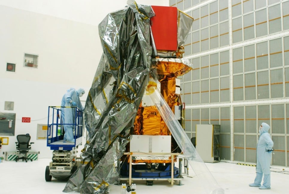
On Tuesday, the European Space Agency (ESA) successfully launched a pioneering satellite designed to measure the carbon storage of rainforests, shedding light on their crucial role in regulating the global climate, reports BBC.
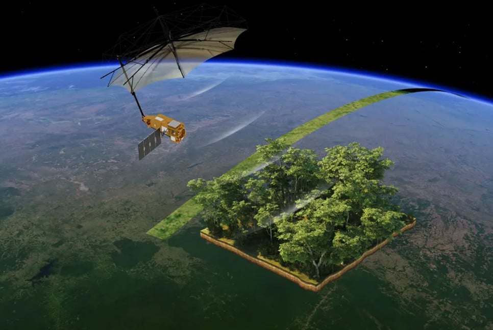
The satellite, launched from ESA’s Kourou space station in French Guiana, uses a special radar system that allows it to penetrate the thick canopy of rainforests and explore what lies beneath.
Its mission is to provide precise measurements of the carbon stored in some of the world’s largest and most vital forests, including those in the Amazon, Congo, and Indonesia.
This data is expected to improve understanding of how these forests store carbon and how deforestation is impacting their carbon storage capacity.
Affectionately nicknamed the "space brolly" due to its large 12-meter diameter antenna, the satellite features P-band radar with a long wavelength that allows it to see deeper into forests than any other radar system currently in space.
Traditional space-based radars have only been able to capture images of the treetops, often missing important data below the canopy.
However, the P-band radar’s longer wavelength enables it to detect not just the forest tops but also the trunks, branches, and woody material beneath the leaves. This material is a crucial indicator of the amount of carbon stored in trees.
Prof. John Remedios, director of the National Centre for Earth Observation, emphasized the significance of this mission: “We can actually look inside these forests for the first time and get a high-accuracy measure of how much carbon is stored, particularly in the Amazon, Congo, and Indonesia.”
The satellite will use a technique similar to that of a CT scan, repeatedly passing over the forests to analyze slices of the trees and calculate the amount of woody material present.
The data gathered by the satellite will act as a proxy for the amount of carbon dioxide sequestered in the forests. Currently, scientists rely on measuring individual trees and extrapolating data across vast areas—a process that is both challenging and imprecise.
Prof. Mat Disney, a remote sensing expert from University College London, explained, “We’re essentially trying to weigh the carbon stored in 1.5 trillion trees across the tropics. Satellites are the only way to do this consistently.”
As the satellite continues its mission, the team will refine their methods and share vital information that could shape future efforts to protect rainforests and combat climate change. By providing detailed, reliable data on forest carbon storage, this innovative satellite is set to become an essential tool for environmental monitoring and global climate action.
Bd-pratidin English/ Afia